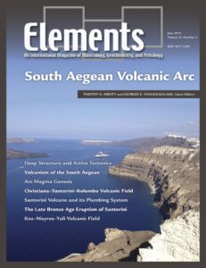
South Aegean Volcanic Arc
Timothy H. Druitt and Georges E. Vougioukalakis – Guest Editors
Table of Contents
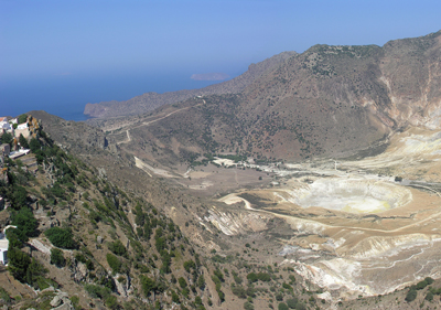
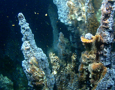
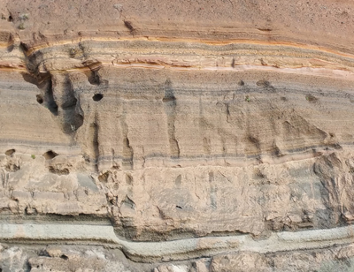
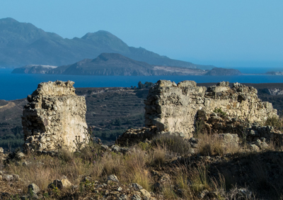
The South Aegean volcanic arc lies at the intersection between Europe, Asia, and Africa, in the cradle of European civilization. Studies over the last decade have transformed our understanding of the arc: subduction architecture and back-arc geodynamics, genesis of the arc magmas, eruption chronology of the arc recorded in marine tephra archives, and hazards posed by eruptions and tsunamis. Santorini is one of the most explosive arc volcanoes in the world, and its ‘Minoan’ eruption of the Late Bronze Age is an iconic event in volcanology and archaeology. Santorini is still dangerous. The Kolumbo submarine crater, best known for its deadly eruption of 1650, today hosts a hydrothermal system and bacterial colonies. In the eastern sector of the arc lies the large submarine caldera formed by the Kos Plateau Tuff eruption. The eruptive mechanisms and petrology of this eruption have now been unraveled, as have the eruptive and magmatic histories of Nisyros and Yali volcanoes on the caldera rim.
- Deep Structure and Active Tectonics of the South Aegean Volcanic Arc
- Volcanism of the South Aegean Volcanic Arc
- Magma Genesis at the South Aegean Volcanic Arc
- The Christiana–Santorini–Kolumbo Volcanic Field
- Santorini Volcano and Its Plumbing System
- The Late Bronze Age Eruption of Santorini Volcano and Its Impact on the Ancient Mediterranean World
- The Kos–Kisyros–Yali Volcanic Field
BIOMIN IV: 15th International Symposium on Biomineralization
CAMECA
Crystal Maker
Excalibur Mineral Corporation
Geological Society
International Association of Geoanalysts
ProtoXRD
Savillex
University of Cambridge Department of Earth Sciences
Volume 15, Number 4 (August) • Weathering: A Unifying Process in the Geosciences
GUEST EDITORS: Patrick J. Frings (GFZ German Research Centre for Geosciences, Germany) and Heather Buss (University of Bristol, UK)
This issue will highlight the integral role of weathering processes across a range of geoscience fields. Chemical weathering – the loss of mass by mineral dissolution and export – is key to understanding how Earth’s skin functions. Weathering is the starting point for the biogeochemical cycles of most elements. It determines river and groundwater chemistry and provides nutrients to ecosystems. Weathering alters rock structure and susceptibility to erosion; soil and landscape evolution cannot be understood without considering the role of chemical weathering. Weathering of silicate rocks is a long-term sink for atmospheric CO2, and has been crucial in maintaining our planet’s habitability over billions of years … and may constitute a geoengineering strategy. The issue will be the state-of-the-art on these topics and will explore the linkages between them.
- The Central Role of Weathering in the Geosciences Heather Buss (University of Bristol, UK) and Patrick Frings (GFZ German Research Centre for Geosciences, Germany)
- The Goldilocks Planet? How Silicate Weathering Maintains Earth ‘Just Right’ James Kasting (Pennsylvania State University, USA)
- How Plants Enhance Weathering and How Weathering is Important to Plants Stephen Porder (Brown University, USA)
- Sculpting Earth’s Surface: The Role of Mechanical Weathering Suzanne Anderson (University of Colorado, Boulder, USA)
- Combating Climate Change Through Weathering of Agricultural Soils Grace Andrews (Southampton University, UK) and Lyla. L. Taylor (University of Sheffield, UK).
- Ice-age Paleoweathering: How do Weathering Rates Vary with Climate Patrick Frings (GFZ German Research Centre for Geosciences, Germany)
- Planet Mercury (February 2019)
- Reactive Transport Modeling (April 2019)
- South Aegean Magmatic Arc (June 2019)
- Weathering: A Unifying Process in the Geosciences (August 2019)
- Catastrophic Perturbations to Earth’s Carbon Cycle (October 2019)
- Kimberlites (December 2019)
Thematic Articles